Key points
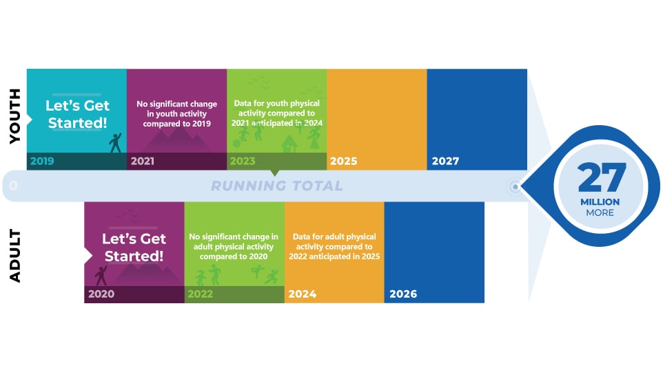
- Active People, Healthy Nation℠ is a national CDC initiative to help 27 million Americans become more physically active by 2027.
- CDC measures progress toward this goal in several ways.

Physical activity levels
CDC will use data from its National Health Interview Survey (NHIS) and Youth Risk Behavior Survey (YRBS) to monitor progress toward this goal.

Learn more about how we are measuring the 27 million goal.
Community design
It is important to be able to safely and easily walk, bike, or take public transit to everyday destinations. These include homes, workplaces, schools, parks, health care, retail, and grocery stores.
Designing communities to provide safe routes for active transport helps increase physical activity. It can also make communities better places to live.
Active People, Healthy Nation monitors communities' efforts to increase physical activity through community design.
The percentage of US adults reporting access to activity-friendly routes to everyday destinations near their homes (NHIS, 2020) was:
- 63% had sidewalks on most streets.
- 59% had shops, stores, or markets they could walk to.
- 53% had bus or transit stops they could walk to.
- 77% were able to walk to places to relax, clear their mind, or reduce stress.
National Complete Streets Coalition maps show the adoption of state, local, and regional Complete Streets policies from 2000 to 2021. Complete Streets policies have been implemented in more than 1,500 jurisdictions.
Champions' support
33 cities, towns, and states have passed an Active People, Healthy Nation Proclamation. Together the proclamations reach more than 11 million people.
Want to stay informed about Active People, Healthy NationSM?
Resources
2022 State Report Cards on Support for Walking, Bicycling, and Active Kids and Communities
State support for active transportation.
Adult Physical Inactivity Prevalence Maps
State maps with overall prevalence of physical inactivity and by race/ethnicity.
American Fitness Index
Ranking of the 100 largest US cities using 34 indicators. These represent health behaviors, health outcomes, built environment, recreational facilities, effective physical activity policies, and appropriate project funding.
Bicycling and Walking in the United States: Benchmarking Progress
Publicly available data on bicycling and walking.
Dangerous by Design
Ranks most dangerous states and metro areas for pedestrians.
Data, Trends, and Maps
National and state data about the health status and behaviors of Americans as well as environmental or policy supports.
Healthy People 2030
National leading health indicators and core objectives related to physical activity.
Park Score
Park access score for the 100 most populated cities in the United States.
PLACES: Local Data for Better Health
Model-based population-level analysis and community estimates. These are for all counties, places (incorporated and census designated places), census tracts, and ZIP Code Tabulation Areas across the United States.
School Health Profiles
Representative data on school health policies and practices in states, large urban school districts, and territories.
